Photo gallery
Event + Exhibition
Find images by browsing the photo gallery by category. Add them to your Pinterest boards. Access the press kit to download the image or view project details.
Create a media account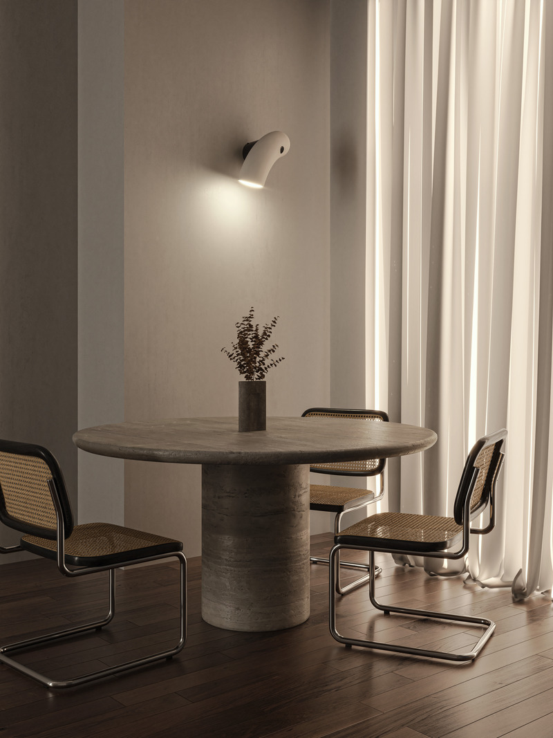
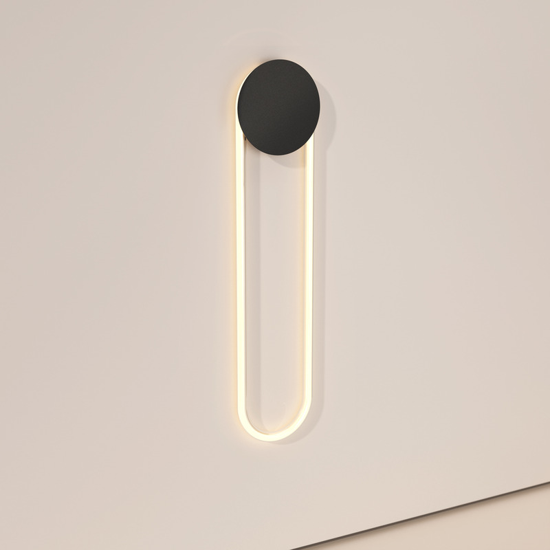
Back at the ICFF/Wanted Design to Introduce the Hyphen Wall and Upgrades on the Iconic RA Collection
d'Armes
Hyphen Wall in Porcelain
Photo credit:
Diego Rapuzzi
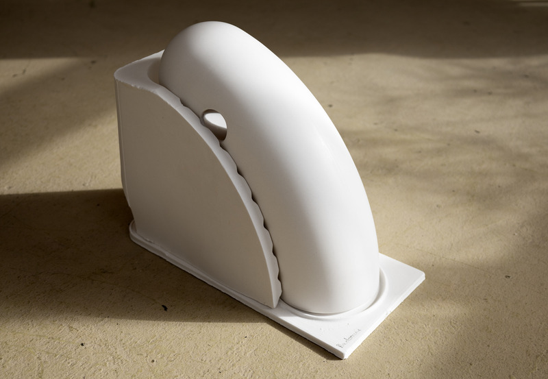
Back at the ICFF/Wanted Design to Introduce the Hyphen Wall and Upgrades on the Iconic RA Collection
d'Armes
Porcelain mold
Photo credit:
d'Armes
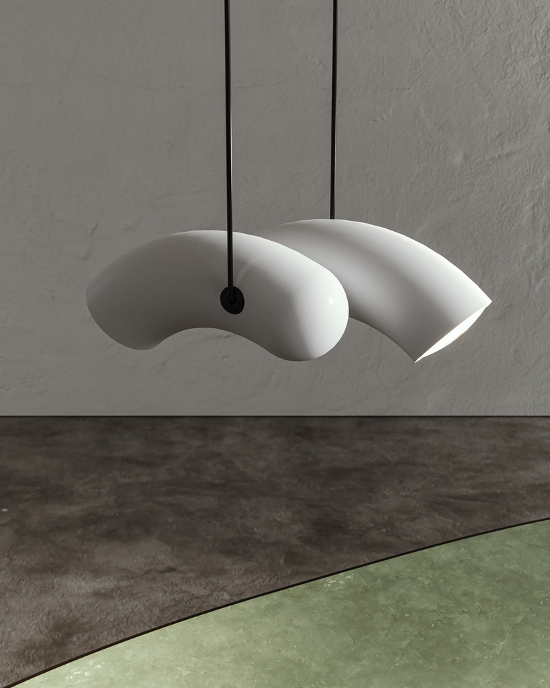
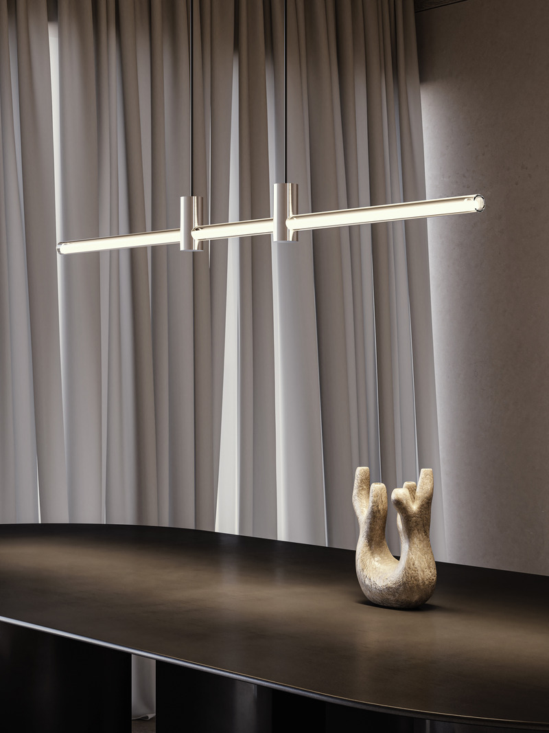
Back at the ICFF/Wanted Design to Introduce the Hyphen Wall and Upgrades on the Iconic RA Collection
d'Armes
Hyphen Pendant in Porcelain
Photo credit:
Diego Rapuzzi
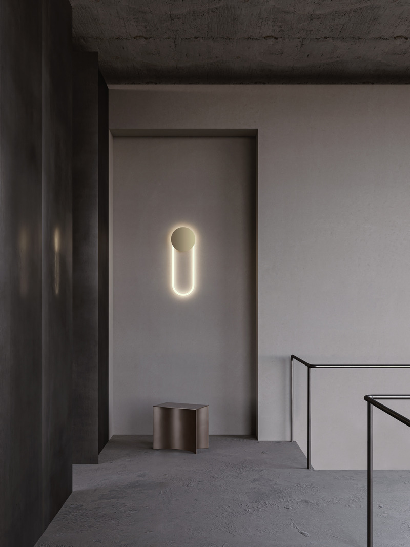
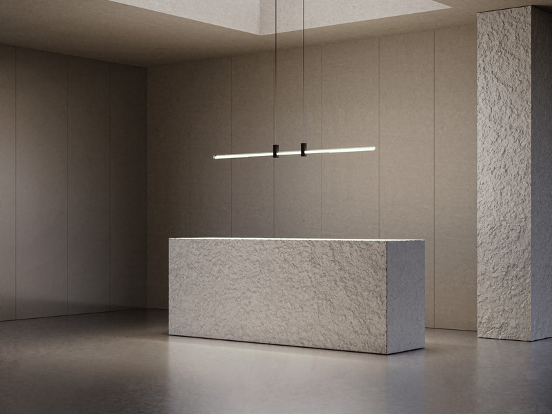
Back at the ICFF/Wanted Design to Introduce the Hyphen Wall and Upgrades on the Iconic RA Collection
d'Armes
Hyphen Pendant in Porcelain
Photo credit:
Diego Rapuzzi
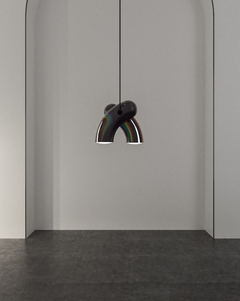
Back at the ICFF/Wanted Design to Introduce the Hyphen Wall and Upgrades on the Iconic RA Collection
d'Armes
Hyphen Pendant in Chromatic Black
Photo credit:
Diego Rapuzzi
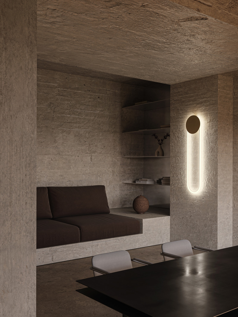
Back at the ICFF/Wanted Design to Introduce the Hyphen Wall and Upgrades on the Iconic RA Collection
d'Armes
Hyphen Pendant in Porcelain
Photo credit:
d'Armes
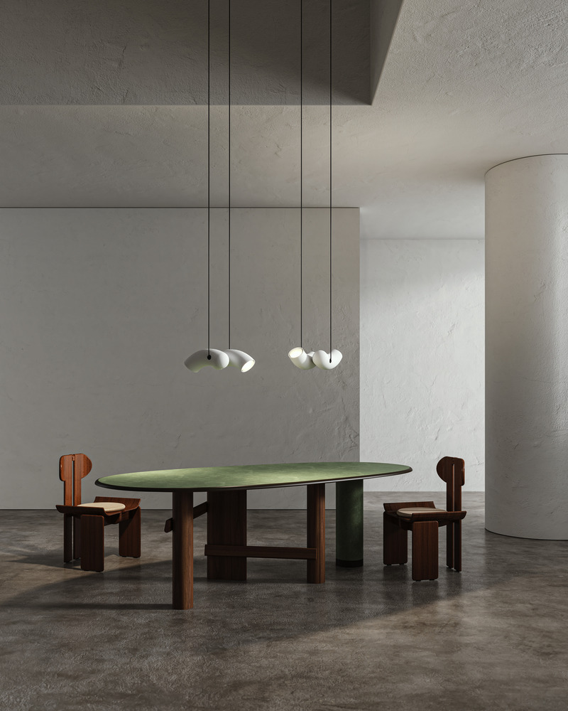
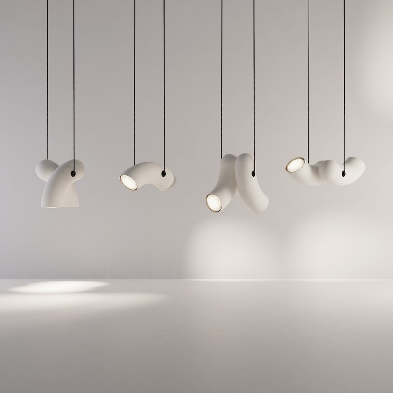
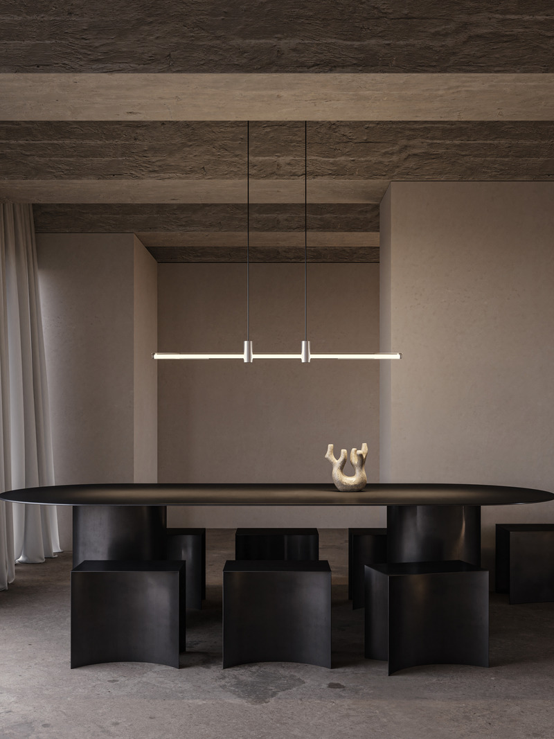
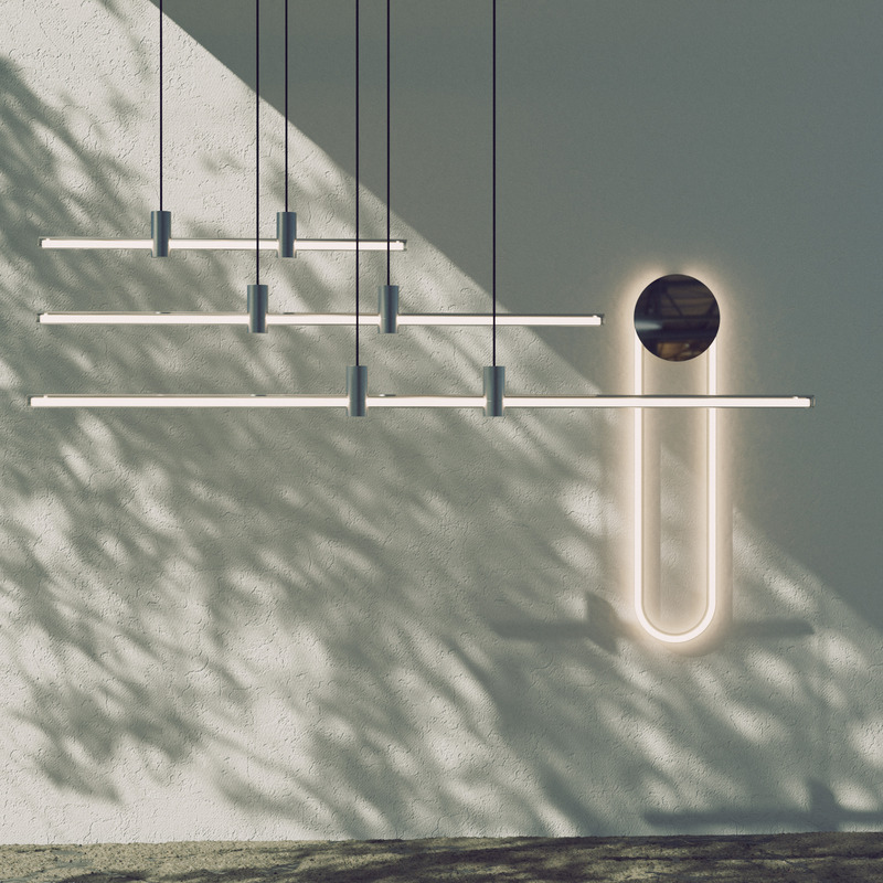
Back at the ICFF/Wanted Design to Introduce the Hyphen Wall and Upgrades on the Iconic RA Collection
d'Armes
Hyphen Collection
Photo credit:
Diego Rapuzzi
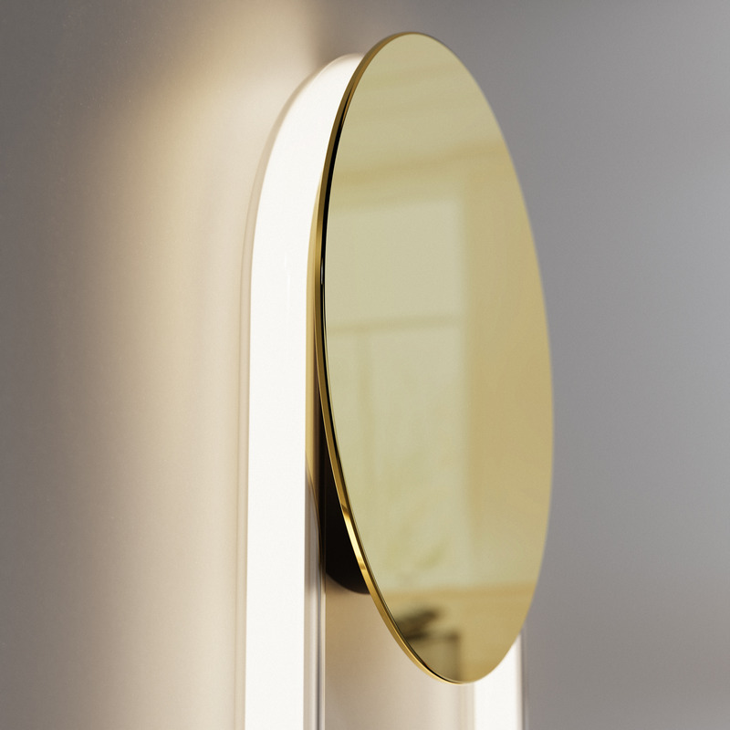
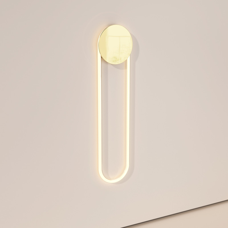
Back at the ICFF/Wanted Design to Introduce the Hyphen Wall and Upgrades on the Iconic RA Collection
d'Armes
RA Wall: Details of 12K gold finish
Photo credit:
d'Armes
Back at the ICFF/Wanted Design to Introduce the Hyphen Wall and Upgrades on the Iconic RA Collection
d'Armes
RA Wall Long in 12k gold
Photo credit:
d'Armes
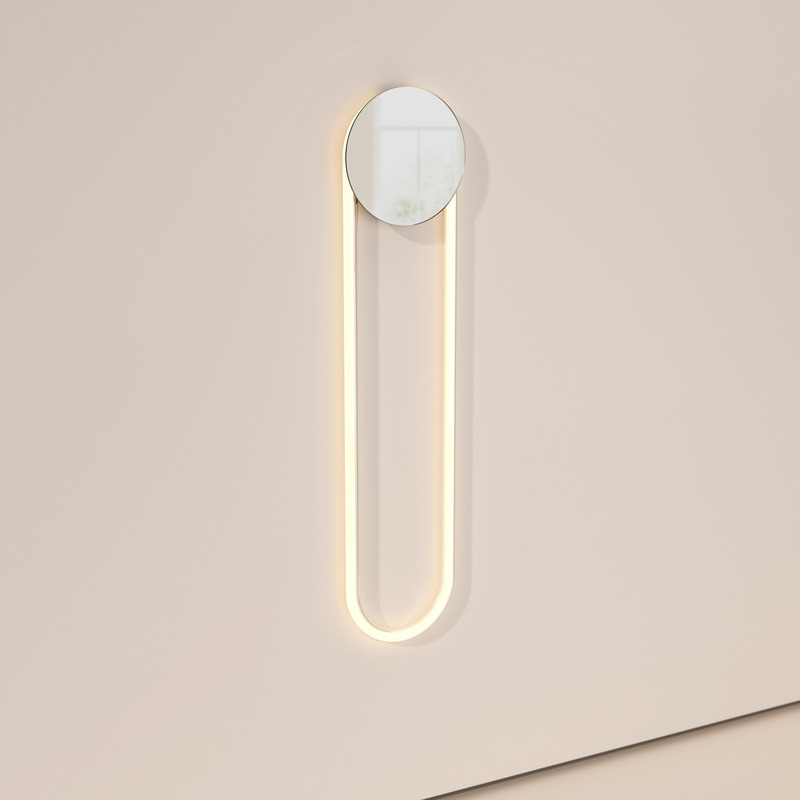
Back at the ICFF/Wanted Design to Introduce the Hyphen Wall and Upgrades on the Iconic RA Collection
d'Armes
RA Wall Long in Mirror
Photo credit:
d'Armes
Advertising
Back at the ICFF/Wanted Design to Introduce the Hyphen Wall and Upgrades on the Iconic RA Collection
d'Armes
RA Wall Long in Black
Photo credit:
d'Armes
Back at the ICFF/Wanted Design to Introduce the Hyphen Wall and Upgrades on the Iconic RA Collection
d'Armes
RA Wall Short in 12K gold
Photo credit:
Diego Rapuzzi
Back at the ICFF/Wanted Design to Introduce the Hyphen Wall and Upgrades on the Iconic RA Collection
d'Armes
RA Wall Long in 12K gold
Photo credit:
Diego Rapuzzi
Back at the ICFF/Wanted Design to Introduce the Hyphen Wall and Upgrades on the Iconic RA Collection
d'Armes
RA Line Medium in Clear Transparent & Clear Anodized
Photo credit:
Diego Rapuzzi
Back at the ICFF/Wanted Design to Introduce the Hyphen Wall and Upgrades on the Iconic RA Collection
d'Armes
Details of RA Line Medium in Clear Transparent & Clear Anodized
Photo credit:
Diego Rapuzzi
Back at the ICFF/Wanted Design to Introduce the Hyphen Wall and Upgrades on the Iconic RA Collection
d'Armes
RA Line Large in Clear Transparent & Black Anodized
Photo credit:
Diego Rapuzzi
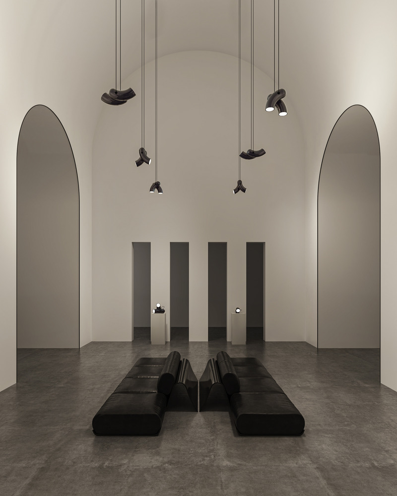
Back at the ICFF/Wanted Design to Introduce the Hyphen Wall and Upgrades on the Iconic RA Collection
d'Armes
RA Line and RA Wall in Black
Photo credit:
d'Armes

Enter Dezeen Awards 2023 before June 1st
Dezeen
Photo credit:
Dezeen Awards 2023
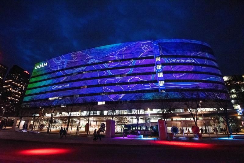
Thought-Provoking Science: Matière à Réflexion, a New Video Projection on the Façade of UQAM’S Président-Kennedy Pavillon, Marks the 100th Anniversary of Acfas
UQAM - Université du Québec à Montréal
Cartographier les inondationsClément BesnardUQAR - Université du Québec à RimouskiFinaliste de l’édition 2015, La preuve par l'image
Photo credit:
Nathalie St-Pierre

Thought-Provoking Science: Matière à Réflexion, a New Video Projection on the Façade of UQAM’S Président-Kennedy Pavillon, Marks the 100th Anniversary of Acfas
UQAM - Université du Québec à Montréal
Lumière sur le relief terrestreGuillaume Légaré-Couture,INRS - Centre Eau Terre et EnvironnementFinaliste de l’édition 2021, La preuve par l'image
Photo credit:
Nathalie St-Pierre
Advertising